Top 10 most beautiful adventure tourist destinations in Vietnam
Successfully conquering your best friend’s limits is always attractive to everyone, which is also the reason why adventure travel is increasingly popular. So conquering beautiful and adventurous natural wonders is becoming a passion to test themselves for many people today. The following Travel Vivu will suggest to you the most beautiful and adventurous tourist destinations in Vietnam, hoping to help you easily choose a tourist destination for each of your trips.
Fansipan peak
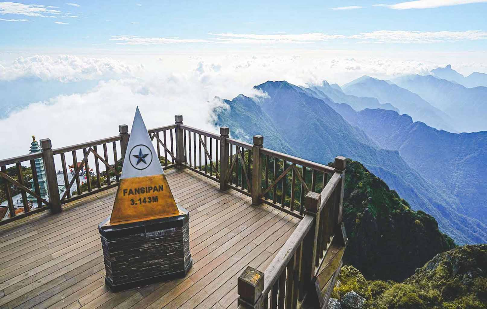
Fansipan Communal House is located in Hoang Lien Son mountain range, about 9 km southwest of Sa Pa town. The mountain is located bordering Lao Cai and Lai Chau provinces in the Northwest region of our country. Fansipan is not only the highest mountain peak in Vietnam but is also considered the “roof” of Indochina. With an altitude of more than 3,100 m, visitors can conquer this mountain by many different paths. If you explore in the “traditional” way, that is, without using the cable car, it will take visitors 2-4 days to travel.
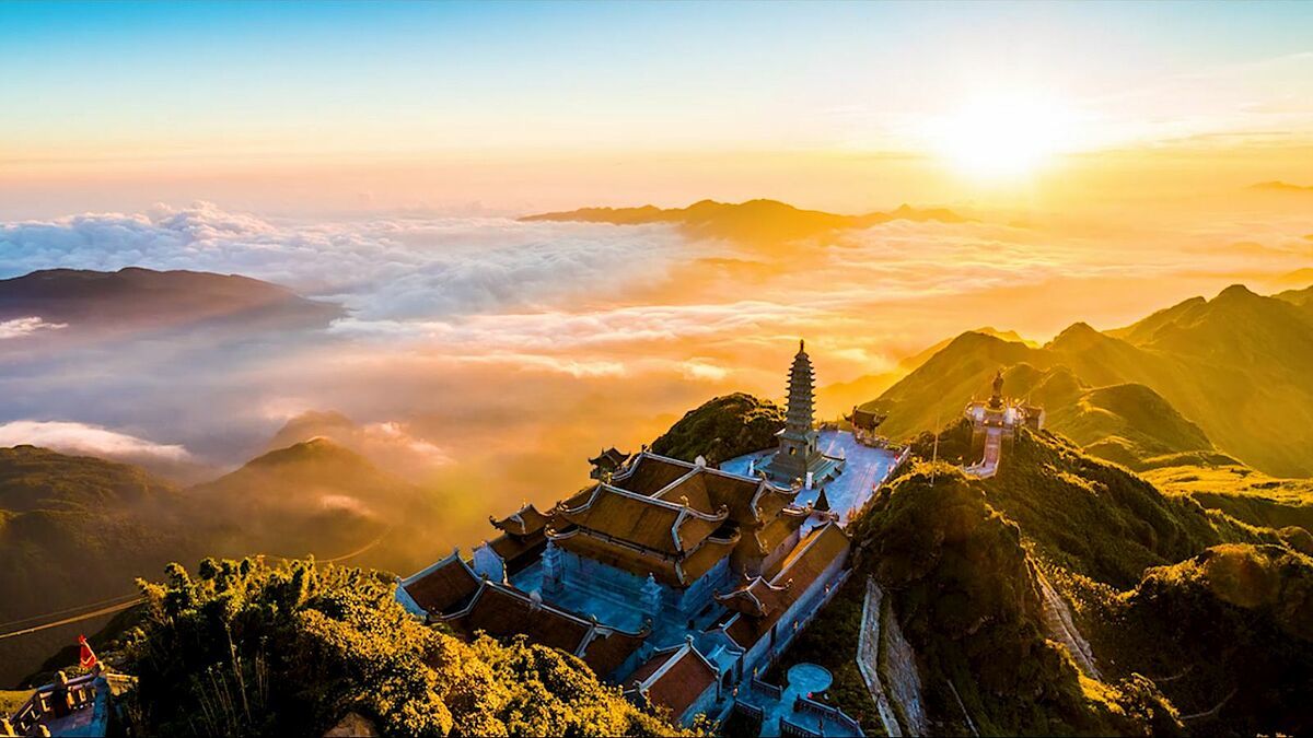
Fansipan is not only a famous peak of the beautiful mountainous region of Sapa but also known as the “city in the clouds”. Once you come here, you will realize that the Northwest mountains and forests are majestic with famous architectural works such as the cable car system to a height of 3,000 m, Bamboo Garden, Bao An Thien Tu, Bich Van Thien Tu, …appears dimly and illusively in the clouds. Therefore, this will probably be a point not to be missed for those who want to hunt for the most wonderful cloud photos.
Address: Tam Duong District, Lai Chau Province
Tay Con Linh peak
If you are a lover of heights and the exploration and adventure routes of the high mountains of Ha Giang, then in addition to the Chieu Lau Thi peak over 2,400m high, you cannot help but be fascinated by the Tay Con Linh range with fog and bitter winds all year round. , the steep and precarious pass next to successive mountain ranges to reach the top of Tay Con Linh.
Tay Con Linh peak is 2,419 meters high and Kieu Lieu Ti peak is 2,402 meters high in Ha Giang province. Coming here, you have to go through zigzag roads with adventurous challenges, one side is a deep abyss, the other is a high steep cliff. When coming here, tourists must definitely visit Xin Man district, travel to Ma Pi Leng pass, visit Lung Cu flagpole and learn a little about Lo Lo ethnic identity.
With the attention and investment of Hoang Su Phi district to exploit tourism along with Chieu Lau Thi range – Tay Con Linh peak will be one of the beautiful locations, a strength to exploit tourism by motorbike and bus. Eco-tourism walking path, explore and experience the majestic beauty of the mountains and forests here.
Address: Phuong Tien Commune, Vi Xuyen District, Ha Giang Province
Lung Cung Peak
Lung Cung peak is 2,913 m high with white clouds covered all year round. The name of the mountain peak is named after a village deep in the most dangerous mountain area in Yen Bai. To get here, visitors can climb from 3 different directions ( from Thao Chua Chai village, Lung Cung village or Tu San village). Before reaching the place where heaven and earth meet and enjoying the majestic beauty of nature, you will have to spend about 2 days going through arduous and dangerous roads through primeval forests, up and down rocky mountains. erect.
The climate here is very fresh with rich vegetation, in the surrounding areas there are also wild flowers such as: azalea, red maple trees and some other flowers. But what is most attractive is that this place still retains its pristine beauty and has never been affected by humans. In recent years, villagers have created their own tourist routes and guided tourists to climb to Lung Cung peak to conquer and explore this peak. Some travel companies are exploiting trekking tours for tourists who like adventure and experience.
Address: Nam Co Commune, Mu Cang Chai District, Yen Bai Province
Nam Kang Ho Tao peak
As one of the most dangerous terrains in the Northwest high mountains, Nam Kang Ho Tao has quite a long climbing route. Here, visitors have to overcome dangerous rock climbs. In some places, the cliffs are high, smooth and have no edges, while below are streams and boulders.
Possesses an altitude of 2,881 m above sea level and is not in the Top 10 highest mountains in Vietnam. This is one of the super beautiful roads that few people know about. Not only that, Nam Kang Ho Tao is likened to a “forgotten dangerous place”. Because steep, slippery cliffs intertwine with dense forests, shielding and blocking all paths… Along with that are streams that are sometimes bare and sometimes flooded, filled with hidden dangers. However, all these scenes of wild beauty carry a special attraction that makes it difficult for adventurous tourists to resist.
Address: Ban Ho Commune, Sa Pa District, Lao Cai Province
Đèo Cả
Deo Ca is the longest adventure road in the Central region located between the slopes of Hao Son mountain and Da Bia mountain with an altitude of over 330m with a total length of 12km connecting Khanh Hoa province with Phu Yen. The winding mountain pass road curves like a giant snake, challenging the bravery of those who like to explore and conquer. Going through Ca Pass, you feel like you are enjoying a feng shui painting with mountains, forests, fields peeking out from behind the green grass on one side, and the clear blue sea with countless anchored boats on the other.
Going up high and looking back, you will see the roads just passed by Deo Ca winding sharply, just like a giant python slithering on a mountain. When traveling through the passes, you will admire the majestic scenery of Deo Ca with a picture of mountains and water, on one side is the vast blue sea, on the other side are towering mountains and forests, all in harmony with the surrounding nature. Heaven and earth create a charming scene that any tourist passing through the pass wants to stop to enjoy and be captivated by the wild, poetic beauty of this place.
If you accidentally pass through this pass during the rainy season, you will be able to see vast fields of golden ripe rice gently surfing in the wind like extremely wonderful waves. The nature and climate here make anyone who passes by here be ecstatic.
Address: Hoa Xuan Nam Commune, Dong Hoa District, Phu Yen Province
Ta Nang - Phan Dung
Ta Nang – Phan Dung passes through 3 provinces of Lam Dong, Ninh Thuan and Binh Thuan and is known as the most beautiful road in Vietnam. However, this is a very difficult tourist destination to conquer and is especially dangerous during the rainy season because of the high mountainous terrain.
This road has a total length of about 55km, surrounded by forests, mountains and wild, beautiful streams. However, when conquering this Ta Nang – Phan Dung route, backpackers not only need physical strength but also must be fully equipped with survival skills, respect for nature and plans to cope with the weather. Many unfortunate accidents that have occurred here are a warning bell about safety for those who set foot in this place.
Address: Ta Nang Commune, Duc Trong District, Lam Dong Province
Bà Đen Mountain
As one of the highest mountains in the South, Ba Den Mountain (Tay Ninh) is always a favorite destination for backpackers or mountain climbing enthusiasts. From the foot of the mountain to Dien Ba – located in the middle of the mountain with a system of shrines and temples, there are 3 transportation options: cable car, slide and walking. Each option takes about 20-60 minutes of travel.
However, from Dien Ban to the top of the mountain there is only one option, which is to follow the trail behind Dien Ba. Visitors must weave through rocks and caves to reach the top. This road has extremely complex and dangerous terrain. Sometimes, visitors will encounter falling rocks or poisonous snakes on the mountain.
Address: Thanh Tan Commune, City. Tay Ninh, Tay Ninh Province
Lao Than Mountain
Known as the most beautiful cloud hunting location in Y Ty (Lao Cai), Lao Than Mountain is a beautiful tourist destination popular with backpackers. But to get here, visitors will have a hard time getting through because the path has many bushes, strong winds, intense sunlight and scarcity of water. Besides, even though it is a trail, there are many turns with sharp roads and many steep slopes. Therefore, tourists need to hire indigenous people to guide them to avoid getting lost in the forest.
For young people who like to hunt clouds, the route on Lao Than peak with an altitude of more than 2,860 m in Y Ty commune, Bat Xat district, is considered a reasonable choice in this winter-spring weather. Lao Than is also known as Nhiu Co San father (distinguished from Nhiu Co San mother in the opposite direction), or Mong people call the mountain Hau Pong San. Along the climbing journey, it brings many emotions to visitors. There are some steep sections, many thorny bushes and “virtual life” spots such as dry trees or precarious cliffs.
In particular, if tourists go into cold weather, they will encounter frost clinging to trees and grass on the way up the mountain. At that time, trekkers will feel the cold air flowing into the northern mountains, causing many places to be covered in ice.
Address: Trinh Tuong Commune, Bat Xat District, Lao Cai Province
Explore caves in Quang Binh
Quang Binh is one of the prominent destinations for adventure tourism in Vietnam because there are tours to explore the extremely rich cave system in Phong Nha – Ke Bang national park. In particular, there is also Son Doong cave, “the largest natural cave in the world”, which has been featured many times in international magazines and media programs. There are many caves and natural areas in Quang Binh that adventurous tourists can explore such as Phong Nha underground river, Thien Duong cave, En cave, Tien cave, Tu Lan,…
In particular, Phong Nha belongs to the Ke Bang limestone mountain region located in . This place is called “the first cave of Thien Nam” with beautiful scenery, protected by lush tropical forests all year round. Phong Nha Cave has a length of 7,729m, a depth of 83m, a height of 50m and is divided into many sub-cave branches such as Bi Ky cave, Tien cave and Cung Dinh cave. This is an underground water cave in the heart of the mountain, with many typical stalactites that make visitors go from one surprise to another.
Address: Son Trach Commune, Bo Trach District, Quang Binh Province
Ban Gioc Waterfall, Cao Bang
Located in the Northeast of our country, Cao Bang is blessed with rich tourism potential such as majestic mountains, forests, rivers, streams, and nature with many wild and primitive features. Coming to Cao Bang, you will not be able to miss the opportunity to see and conquer Ban Gioc Waterfall – the fourth largest waterfall in the World among the beautiful waterfalls located on the border between countries and is a large natural waterfall. most in Southeast Asia.
Viewed from a low angle, the waterfalls look like silk ribbons, captivating many visitors and photographers. September and October is the ideal time to explore Ban Gioc waterfall, when the water is abundant and clear, the waterfalls flow with white foam. At the waterfall, visitors can rent bamboo rafts from people to visit around, for about 50,000 VND per person.
Address: Dam Thuy Commune, Trung Khanh District, Cao Bang Province
